Online Magazine
Recent Posts
- Safeguard your Cellphone Photos
- Black & White to Color – Instantly
- Wearing Many Hats
- Video Roundup
- Rescuing Your Blurry Pictures
- Showing Their Age
- What is Your Angle?
- Panorama Photos
- Humorous Photos
- Close Ups
- Fisheye Pictures
- Photo Antiquities
- Printing Big
- Appreciating Scale
- Celebrity Sightings
Tags
More Places to Go
- Free "How-To" Books “How To” books for popular cameras 0
- Vist Us on Facebook keep in touch with us on Facebook 2
Archives
- July 2023 (1)
- March 2023 (2)
- February 2023 (1)
- December 2022 (1)
- October 2022 (1)
- September 2022 (8)
- August 2022 (9)
- July 2022 (1)
- June 2022 (1)
- June 2021 (1)
- May 2021 (1)
- March 2021 (5)
- February 2021 (4)
- January 2021 (2)
- April 2019 (1)
- March 2019 (1)
- February 2019 (1)
- October 2018 (2)
- April 2018 (1)
- March 2018 (4)
- February 2018 (1)
- November 2017 (1)
- August 2017 (1)
- June 2017 (1)
- April 2017 (1)
- March 2017 (5)
- February 2017 (2)
- January 2017 (1)
- October 2016 (1)
- September 2016 (1)
- August 2016 (1)
- July 2016 (1)
- May 2016 (1)
- April 2016 (1)
- March 2016 (2)
- February 2016 (1)
- January 2016 (2)
- December 2015 (1)
- November 2015 (1)
- October 2015 (3)
- April 2015 (1)
- March 2015 (5)
- February 2015 (1)
- January 2015 (4)
- December 2014 (2)
- November 2014 (5)
- October 2014 (2)
- September 2014 (1)
- August 2014 (2)
- July 2014 (1)
- May 2014 (1)
- April 2014 (5)
- March 2014 (5)
- December 2013 (2)
- November 2013 (18)
- October 2013 (1)
- September 2013 (1)
- August 2013 (1)
- July 2013 (1)
- June 2013 (3)
- May 2013 (1)
- April 2013 (2)
- March 2013 (1)
- February 2013 (1)
- January 2013 (1)
- December 2012 (1)
- November 2012 (2)
- October 2012 (2)
- September 2012 (5)
- August 2012 (2)
- July 2012 (1)
- June 2012 (1)
- May 2012 (1)
- April 2012 (4)
- March 2012 (1)
- February 2012 (1)
- January 2012 (3)
- December 2011 (1)
- November 2011 (3)
- October 2011 (1)
- September 2011 (2)
- August 2011 (2)
- June 2011 (3)
- May 2011 (4)
- April 2011 (8)
- March 2011 (8)
- February 2011 (10)
- January 2011 (6)
- December 2010 (11)
- November 2010 (14)
- October 2010 (6)
- September 2010 (12)
- August 2010 (2)
- July 2010 (4)
- June 2010 (3)
- May 2010 (1)
- April 2010 (1)
- March 2010 (2)
- February 2010 (1)
- January 2010 (1)
- December 2009 (1)
- November 2009 (2)
- October 2009 (2)
- September 2009 (1)
- August 2009 (3)
- July 2009 (2)
- June 2009 (1)
- May 2009 (2)
- April 2009 (1)
- March 2009 (2)
- February 2009 (1)
- January 2009 (3)
Your Mind’s Eye
30th November 2013
It May be too Limiting
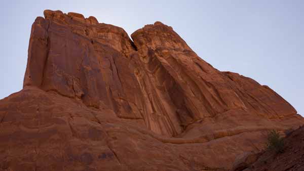
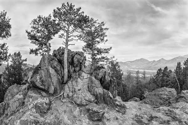
What do you visualize of when you hear someone say that they are going to visit Colorado?
Most of us already have a picture in mind even before that person finishes his/her sentence.
It doesn’t matter if they are visiting New York City or Texas, Paris or Timbuktu. And of course it doesn’t matter if we’ve never before visited that place. We’re all influenced by our mind’s eye – the previous information and images that we’ve associated with that particular place.


So I keep telling myself: don’t fixate on the “mind’s eye”. I tell the photographer in me to keep eyes wide to everything when traveling. Colorado is more than the Rockies, New York City is more than the Statue of Liberty, Texas is more than the Alamo and Paris is more than the Eiffel Tower.
Written by: Arnie Lee
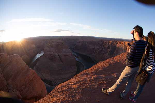
About this Photo – Horseshoe Bend
15th November 2013
The Rest of The Story
This article is the another in a series of articles that I’ve called “About this photo” to draw attention to a few of those memorable photos that may be hiding in a shoebox or on your hard drive.
I’ve been wanting to visit the iconic Horseshoe Bend for many years and I finally had my chance a few weeks ago.
As its name suggests, the Colorado River makes an abrupt 270 turn in the shape of a horseshoe. It’s located downstream from the Glen Canyon Dam and Lake Powell near the city of Page, AZ. Drive 5 miles south on US89 from Page and you’ll see a gravel parking lot. From there a half mile hike on a moderately sloped dirt trail brings you to the overlook.
I arrived late in the day and found quite a few onlookers and photographers awaiting the sunset.
|
The overlook is about 50 yards across and provides a wonderfully wide view of the river – both upstream and downstream. The Colorado sits below the jagged cliffs about 1000 feet down. These spectators are standing pretty close to the edge of the cliff. And while I love the scenic surroundings, I am not a big fan of steep cliffs so I made it a point to stay behind this couple. |
 |
|
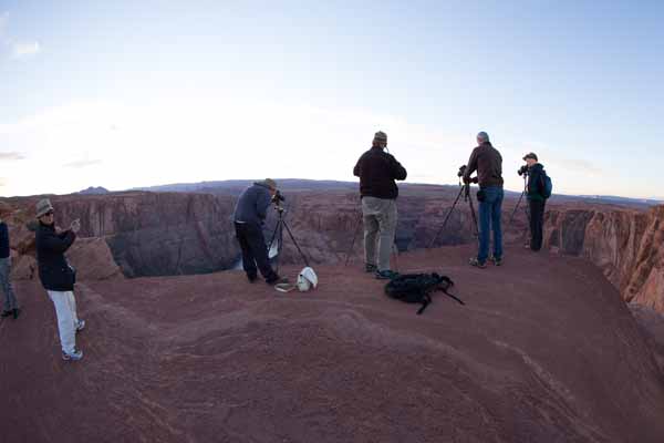
There’s plenty of room to accommodate dozens of visitors without feeling crowded. As you can see these photographers had lots of space in which to set up their equipment while waiting for the sun to go down. From this vantage point, the cliff on which they are standing looks safe……. |
 |
|
However, in this next photograph I’ve stepped away from the edge so that you can see the rock platform on which they were positioned. These people are a lot more brave than me. I couldn’t bring myself to stand next to them. I wasn’t about to stand just inches from the cliff’s edge that drops down by a thousand feet. No, not this photographer. |
 |
|
|
|
|
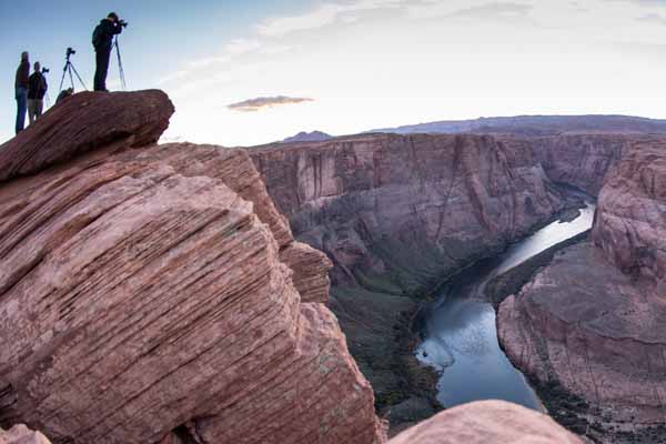
So how did I get this unobstructed view of Horseshoe Bend? As Paul Harvey would say here’s “the Rest of the Story”. |
|
|
My shooting position was immediately to the left of the four photographers with tripods. To take this photograph, I laid on my stomach and carefully crawled to the edge of the cliff. My camera was safely hanging from my neck by its strap. Since I had a very wide angle lens (15mm), I first took a deep breath to get some courage, leaned over the edge, calmly composed the scene in the viewfinder and finally snapped about three shots. |
 |
|
|
|
So there you have it. By itself, this Horseshoe Bend photograph certainly doesn’t tell the story behind it. To inject a slight bit of humor here, let me say that I’m not afraid of heights, only of falling from them. I wasn’t going to leave the overlook until I had my shot. A little dirt on my clothes is the price that I had to pay to get it.
Written by: Arnie Lee
Roadtrip and the Statistics
04th August 2013
We just returned home after spending the last several weeks on the road. This was our annual summer vacation and as is customary, this outing was another cross-country road trip.
| From July 6 to August 3 (that’s 4 weeks), we traveled by auto from our home in Grand Rapids, Michigan to the west coast and southwest to explore many of the scenic areas and to attend several family events.
From our starting point in Michigan (latitude 42.9633° N longitude 85.6681° W), we drove in a wide loop around several of the western states (exactly 17 states). We followed the Interstate highways (I-196, I-94, I-294, I-90, I-84, I-5, I-15, I-70, I-76, I-80) for about 75% of our route. Twenty percent of the route was over excellent US highways (US 2 and US 34) and only a small portion (5% or so) on horrible, unimproved roads (CA 58, for example). |
 |
| Our vehicle was a Honda mini-van for three adults (my wife, her sister and myself) and two of our grandchildren (ages 7 and 8).
There was plenty of room for the five of us when we snapped this tongue-in-cheek photo of the rear luggage area (38 cu ft). The remaining front passenger area actually had lots of room (172 cu ft). |
 |
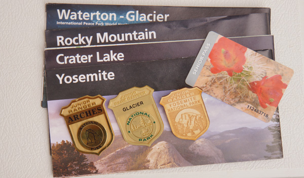
| As an avid fan of our National Park system, I was armed with my Senior Pass. Those of us who are 62-years and older can purchase a lifetime pass for only $10. This is a substantial discount from the $75 annual or $20 per entry pass for younger visitors (61-years and below).
We visited six National Parks on this roadtrip and the two grandkids earned several Junior Ranger badges by completing the requirements during these stays. |
 |
| I used a pad to keep track of the fuel usage. Here’s some of the travel statistics –
Duration: 28 days |
 |
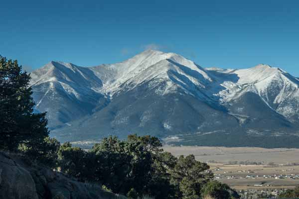
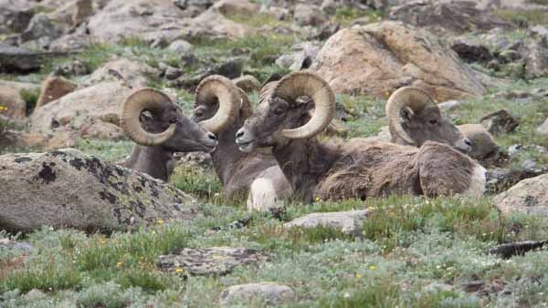
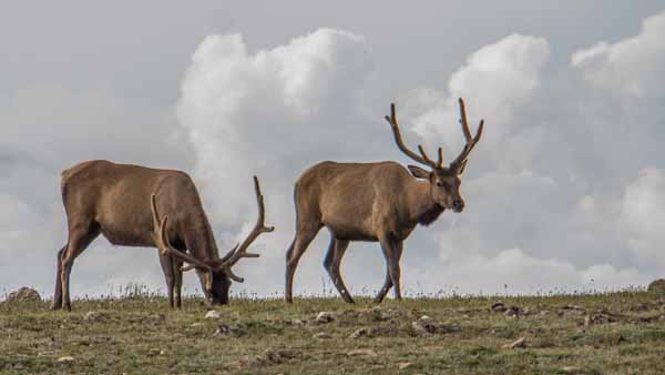
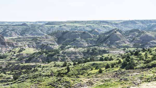
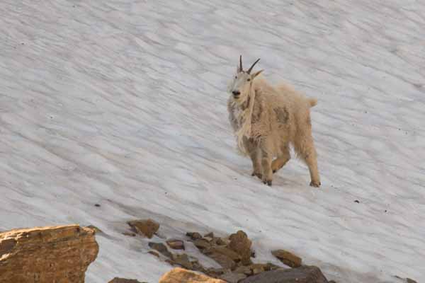
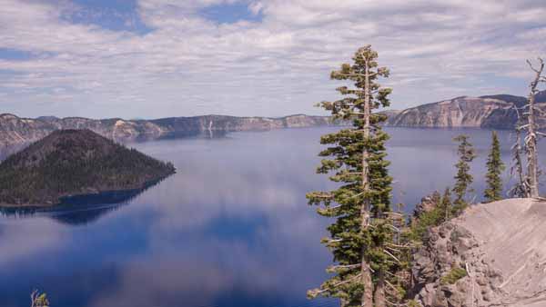
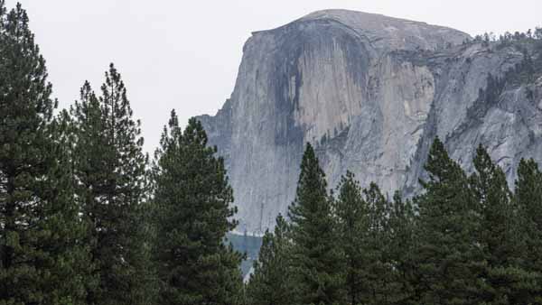
| Another statistic pertains to photography. With six National Parks under our belts and the many other places that we visited along the way, I kept busy shooting pictures. In all I recorded more than 1500 keepers.
I used two cameras – a Sony NEX7 with 18-200mm lens and a Canon 6D with 8-15mm fisheye and 100-400mm telephoto lenses. The Sony NEX7 has a built-in panorama feature which I used frequently. I also enjoyed working with an Eye-Fi SD card in the Sony NEX7. The Eye-Fi card transmits images from the Sony NEX7 directly to my iPhone automatically. This let me review the photos at my convenience. And while the Canon 6D has built-in Wi-Fi capability, I did not use it on this roadtrip. Below are my picks from each one of the National Parks. |
||
 |
 |
 |
|
|
||
 |
 |
 |
|
|
||
Of course, these boring statistics hide the real roadtrip.
Our vacation was not only about spending time together in the vehicle (we clocked roughly 140 hours driving) as we visited with family in Oregon City and Reno (which are 530 miles apart). Reno is nearby our favorite Lake Tahoe (an easy 50 mile drive) where we spent 2 days swimming its crystal clear waters (albeit a little chilly at 65 degrees). Also in Reno we invested a cool $120 at the arcade in Circus Circus to bring home 27 stuffed animals – what a deal! In Yosemite we hiked the Merced Grove trail to pay our respect to the 2000+ year old Sequoias that reach more than 250 ft towards the heavens. A two-day jaunt to Moro Bay on the Pacific coast gave the grandkids the opportunity to collect rocks and sea shells (120 of them weighing twelve pounds). Then onto a family reunion (would you believe 90+ relatives) in Las Vegas. Believe me when I say that July is not most opportune time to be in Las Vegas (the temperature was 106 degrees). As if the heat there wasn’t enough, we stopped at a hot springs in Colorado to bask in its healthy but soothing waters (104-degree pool). And in a moment of driving indecision we backtracked (more than 200 miles) to visit our last National Park. There we climbed the tundra at the top of Trail Ridge Pass which is 11,800 ft above sea level. Anxious to get home, we made the final leg home from Sterling, CO to Grand Rapids (1050 miles in 17 hours).
While I’d like to share the other 1494 photos with you, these will have to wait for another article.
Roadtrip! There’s still several more weeks to enjoy the summer vacations. I hope you can get out there to enjoy our fabulous country. Did I hear roadtrip?
Written by Arnie Lee