Tag Archives: Las Vegas

Drone Time

Talking to Potensic Corp


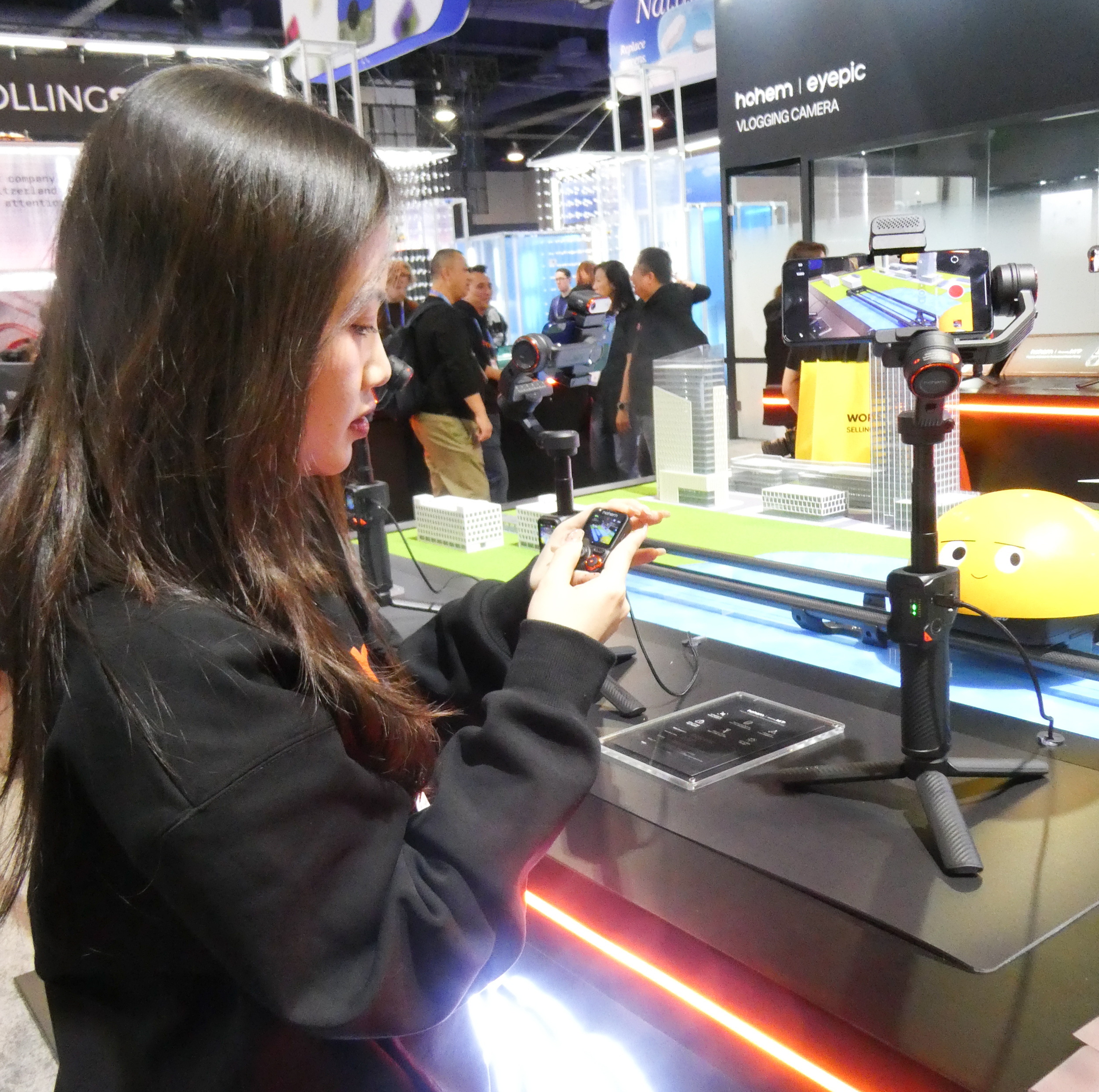
Walking through the endless aisles at this past January’s Consumer Electronics Show I came upon a familiar name Potensic.

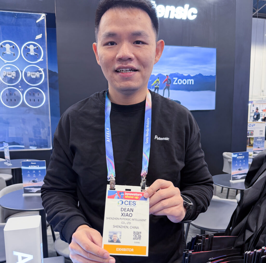
Since I have one of their Atom 2 compact drones, I stopped to talk to Dean one of their representatives. I wanted to find out if they had any other accessories that I might use with my device.


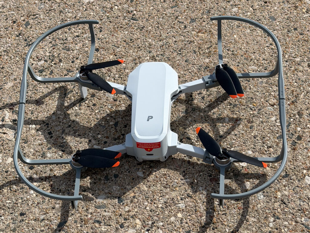
The first thing he pointed out were the grey propeller guards.

I asked Dean about these and he said they were for users who fly their drones indoors and protect both the drone and any users from the rotating propellers. They are also useful for added safety when flying near trees or buildings.

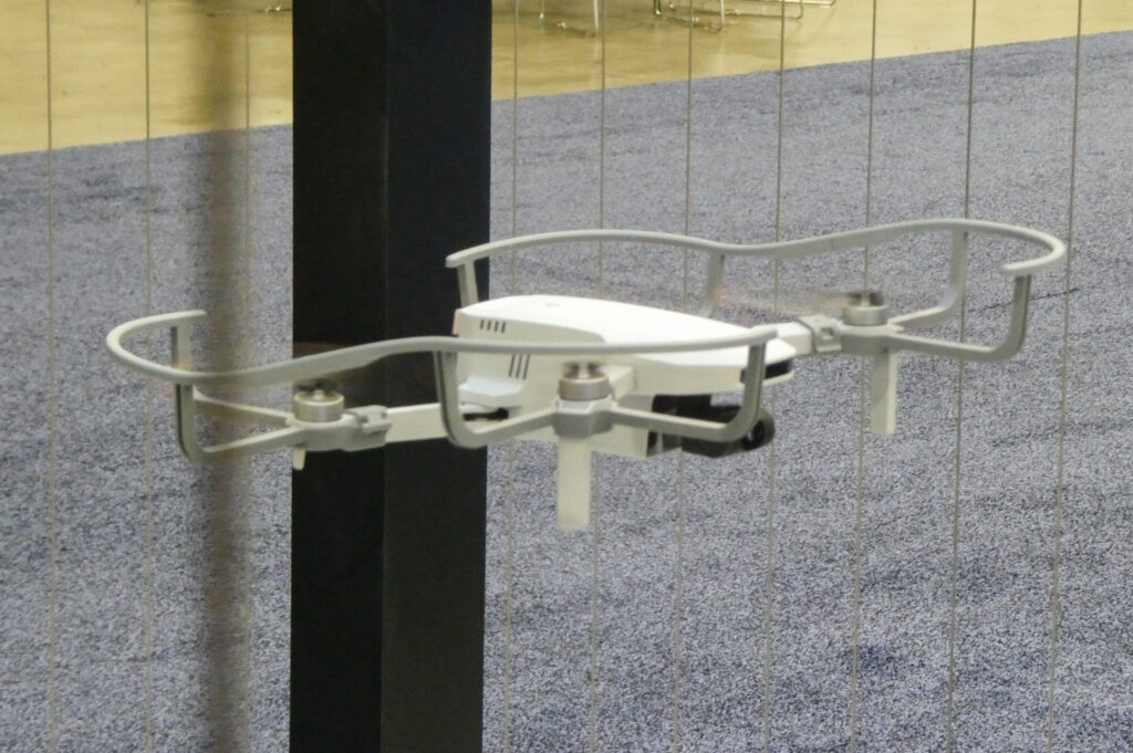
While the guards add a few ounces of weight to the drone and require slightly more battery power when taking off and flying they help stabilize flight in windy conditions. Targeted at the beginner drone pilot, the are not required but are helpful when learning to fly the device.

Clip showing the Atom 2 with propeller guards

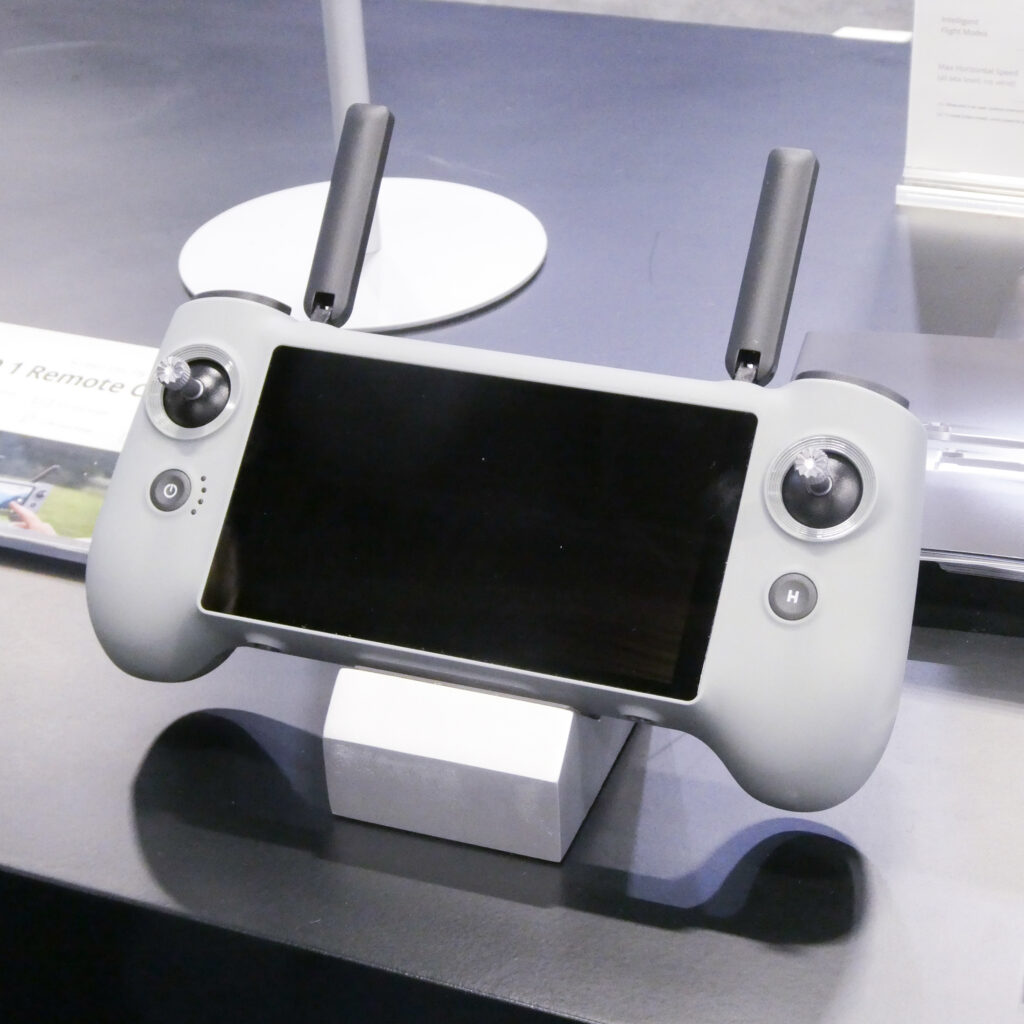
The second thing he pointed out is their new PTD-1 controller. It has a built-in screen, internal memory for video recording and slot for mini-SD card for expanded storage for movies and photos.

It eliminates the need to use a mobile phone (either iPhone or Android) with their standard controller.


For those interested the propeller guards costs about $30 per set .

The new PTD-1 controller costs about $280.


Not long after I returned home from CES I ended up ordering a set of propeller guards for my Atom 2.

Since I’m closer to a beginner than an advanced pilot I feel more comfortable using the guards.

This afternoon I fired up the drone with the propeller guards to video the roof overhang on our porch. I wanted to see if there was snow up there (it’s still cold here in Michigan). There were a few small spots of snow and you can clearly see the snow on the grass below.

Although the Consumer Electronics Show has been over for two months now, I keep looking back to some of my encounters there with so many interesting electronic devices.

I’m looking forward to CES 2027.

Written by:

Arnie Lee

Better Videos

with your mobile phone

I enjoy attending the Consumer Electronics Show to see the plethora of different devices that are available to a gadget junkie such as myself. This past January I again walked through the miles of the Las Vegas Convention Center to see what might attract my attention. One of the booths was Hohen.

Hohen makes a series of handheld gimbal equipped devices.

These devices are for enthusiasts and professionals who want to shoot better quality movies by stabilizing their videos. They also have other features such as remote control, built-in lighting, subject tracking and more.

Their representative demonstrated a few of the features for me and I was impressed.

When I returned home, I ended up purchasing the V3 model
It has a builtin tripod, telescoping extension and auxiliary fill light.
This closeup shows the controller which is removable for remote use.
Here my mobile phone is mounted on the gimbal. On the left is a small fill light and the tracking sensor.
This short video demonstrates the tracking capability of the gimbal. The representative has ordered the gimbal to follow the movement of the yellow ball. You can see the camera moving on the gimbal as the yellow ball progresses on the track.

The unit communicates with your mobile phone with bluetooth. The mobile app has multiple templates to make it easy to produce fun and exciting movies. You can add various filters and create slow-motion and timelapse content.

Hohem’s V3 model sells for about $125 and has so far proven to be a good investment. I’ve happily added this gimbal to my photography accessory bag and am hoping that the quality of my movies improves.

The Hohem X3 model lacks the telescoping extension and the builtin fill light but sells for about $65.

Written by:

Arnie Lee

Mercury

Places that you may have never heard of

As I was driving south on US-95 from Beatty, NV back to Las Vegas I saw this sign.

The name of the place was interesting so I took the exit.

Mercury has a name that is truly unique.I spotted this sign after visiting Death Valley National Park on the highway returning to Las Vegas.

Driving a few hundred yards down the exit road, I encountered this sign.

To comply with the terms of this sign I turned my car around, got back on the highway and made my way back towards Las Vegas.

The sign had already peeked my interest so when I got back to the hotel I did a little research about this place. Here is what I learned.

It’s suspected that mercury was discovered in the surroundings in the mid 1800s and the miners used a road through the area to reach the mines, thus the name. Characterized as a wasteland it went unsettled for a hundred years. The town sits just 5 miles from Hwy US95.

In 1950 the Atomic Energy Commission decided to develop Base Camp Mercury for atomic testing. Initially the AEC built office spaces and living accommodations for employees. Soon many more employees were needed requiring additional temporary facilities including housing, storage, schools, eating , church, banking, recreational and entertainment facilities. In 1954 Base Camp Mercury became Mercury, NV.

By the early 1960s there were more than 10,000 employees in Mercury. To accommodate the workforce the AEC undertook construction of more permanent facilities. The task of the AEC was to study and develop peaceful uses for nuclear energy. These activities continued for years but by the mid-1990s the nuclear testing was discontinued. As a result the town lost most of its population. Since then most of the facilities constructed for the workers have been demolished.

Mercury continues to be part of the larger Nevada National Security Site. Its mission is to operate multiple “facilities delivering technical and service solutions in support of national security”. The NNSS is overseen by the Department of Energy.

For reference this map shows Mercury (towards bottom) in relation to other military installations in southern Nevada. You can see that the map also shows the iconic and secretive Area 51 at Groom Lake.

Credit for this map:

By Finlay McWalter – USGS Topo mapsGIS data in NASA World WindNationalAtlasDreamland resortGroom Lake Desert RatGlenn CampbellFAA Aeronautical chartWikipedia maps of Nevada and the western USANevada DOT air transportation map The following will be corrected in a future version of this map:Indian Springs Air Force Auxilliary Field was renamed Creech Air Force Base in 2005The designation for Nevada State Route 374 should be drawn on the Nevada side of the border. The road’s equivalent on the California side, Daylight Pass Road, is unnumbered., CC BY-SA 3.0, https://commons.wikimedia.org/w/index.php?curid=310530

Other References:

Mercury, Nevada Wikipedia

NNSS – Nevada National Security Site


Still Interested?

Here are a few more places that you may never have heard of –

Argenta, Nevada
Aragonite, Utah
Dunphy, Nevada
Jackpot, Nevada
Rhyolite, Nevada
Vedauwoo, Wyoming
Wamsutter, Wyoming

Written by:

Arnie Lee