As a big fan of aviation I make sure that I have a camera with me whenever I’m near an airport. Sometimes I’ll even make a special trip to an airport especially if it has a viewing area.
There’s one such viewing area alongside Harry Reid International Airport in Las Vegas. For those of you familiar with the city, the viewing area is on Sunset Road towards the east end of the airport. Here you will get a very clear view of aircraft landing on runway 26L. Below are a few shots that I captured recently.
Below is a short clip of my flight into LAS two days earlier
Hopefully you enjoyed seeing these airplanes as much as did.
It’s a three and a half hour flight from Las Vegas back home to Grand Rapids. Unlike many of the other travelers who nap or watch movies on their cellphone, I spend most of this time looking out of the window.
I’ve been an aviation enthusiast since I was a young kid. Later on we had a company that made flight simulator software. So all-in-all I’ve had many opportunities to observe the skies and terrain from above for both hobby and profession. In short, I enjoy flying.
Follow me it you too have this interest.
AAY Flight 2177 from LAS to GRR takes us over the Rockies and the central part of the USA.
For the most part on this January day the skies were cloudless so I had a nice view of the scenery and terrain during daylight.
Here we are taxiing for takeoff. The huge pyramid is the Luxor Casino Resort.
The airport is adjacent to the iconic LV Strip so you can see some of the city’s many casinos.
During takeoff you have a nice view of The Strip
The Sphere is one of Vega’s newest attractions.
As the aircraft turns you can see the Las Vegas Speedway to the north.
Now turning east we pass by the Mountain View Solar facility.
Echo Bay is part of Lake Mead which supplies most of the water and electrical power (with the help of the Hoover Dam) for LV
Heading northeast we see the Colorado River snaking through the White Canyon area in northern AZ/southern UT
This is the San Juan River in Utah feeding the Colorado River and eventually Lake Powell
As a “nerd” I ook for airports below. This is the Montrose Muni Airport (MTJ) in Colorado
Cheyenne County Muni Airprot (SYF) in Kansas
Central Nebraska Regional AIrport (GRI) Grand Island, NE
As we fly over Iowa we caught this guy just passing by
Arriving in Grand Rapids we can see the marshallers working in the 10-degree temperature
After leaving a warm and sunny Las Vegas we arrived to western Michigan’s snow and cold.
Another flight completed and a bunch more photographs for my archives. Can you tell that I’m an aviation geek?
I just returned from a trip west from our home in Michigan. As usual I had my camera with me to record some of the events during the flight back from Denver.
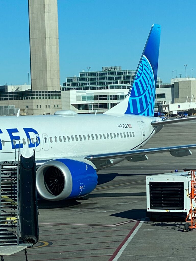
This is our aircraft at the gate in Denver. It is a Boeing B737 Max.
I’m always hoping for clear, cloudless skies. During the flight I’m continuously looking out of the window at the scenery below. One of my “hobbies” is to photograph airports from above. It’s relatively easy to spot an airport because of the long, straight runways which stand out from the surrounding scenery.
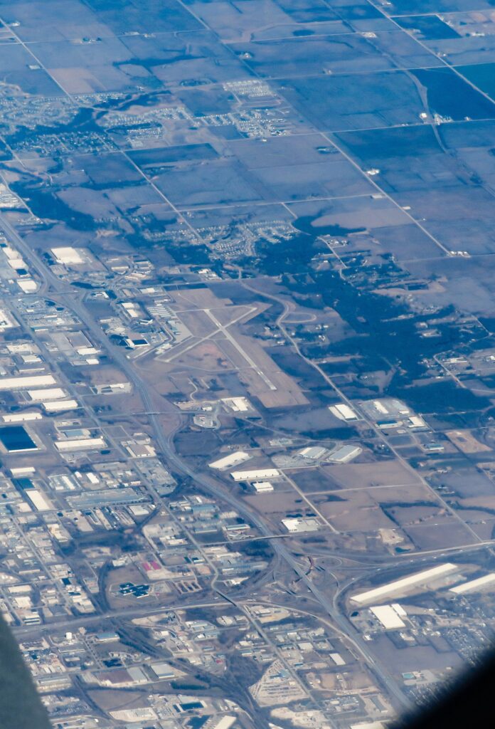
This is the Ankeny Regional Airport. It is located a few miles north of Des Moines, Iowa.
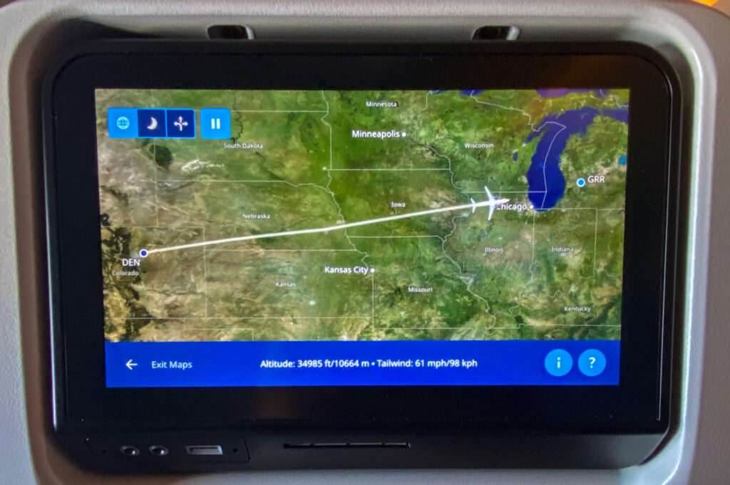
Our flight took a route that was close to a straight line from Denver to Grand Rapids, Michigan. It is relatively easy to determine the location of the plane from the map that is displayed on the seat back screen.
Our aircraft was equipped with seat back displays. One of the view options is to show the flight progress. This helps to identify the scenery as I take photos from the plane’s window.
By referring to the seat back display I was able to look for landmarks that help me determine the area below.
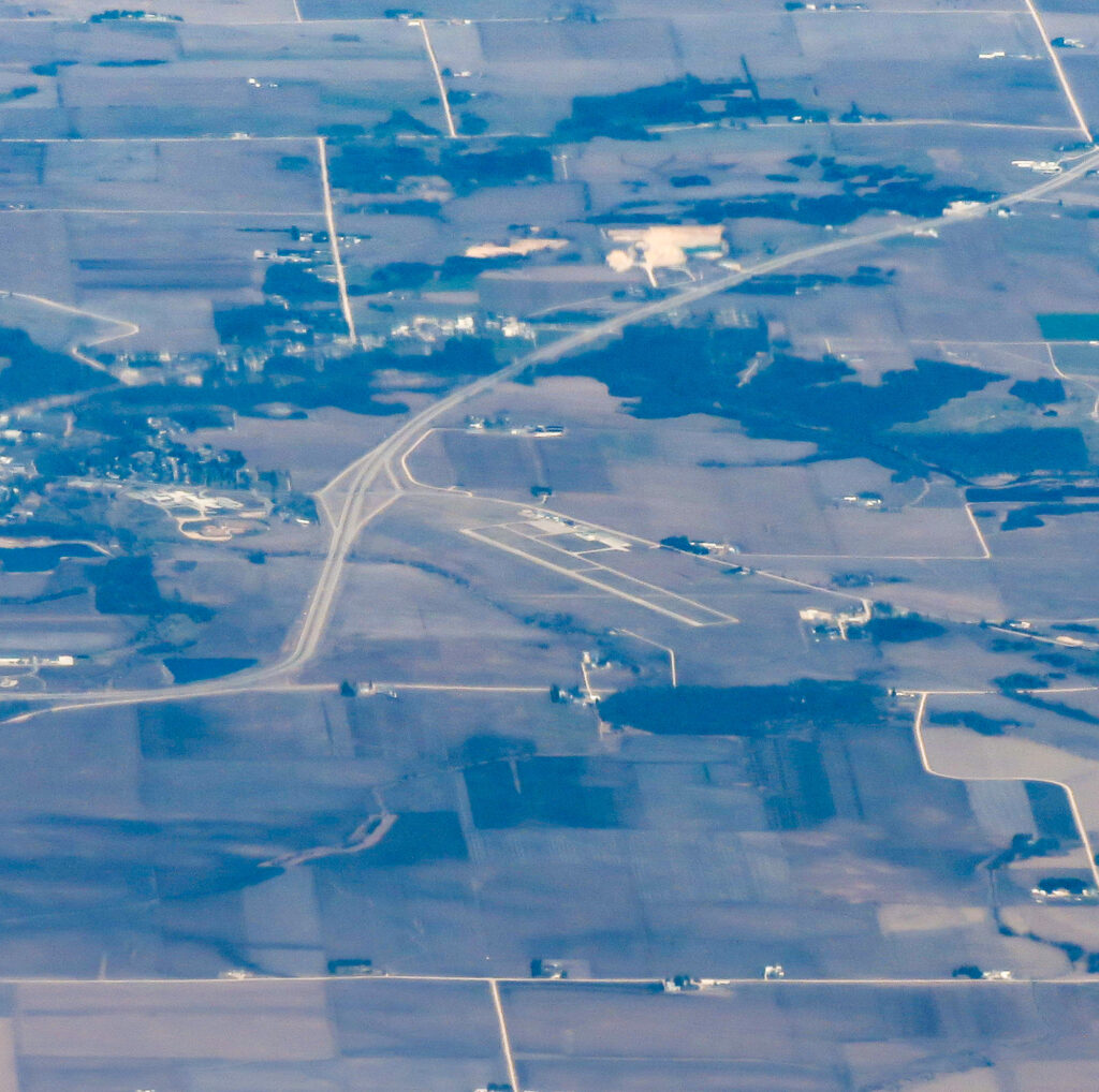
This is the Monticello Regional Airport located northeast of Cedar Rapids, Iowa
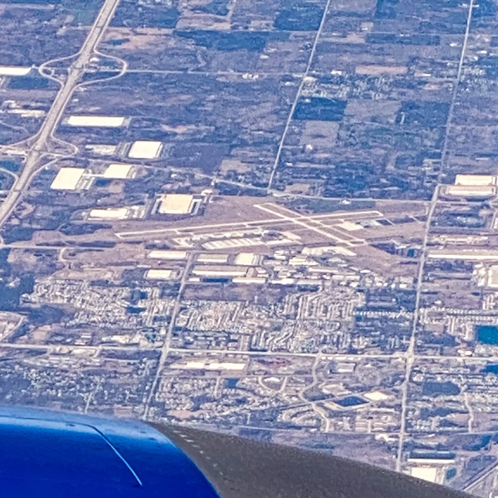
Here is the Kenosha Airport. It is located in Wisconsin just north of the Illinois state line.
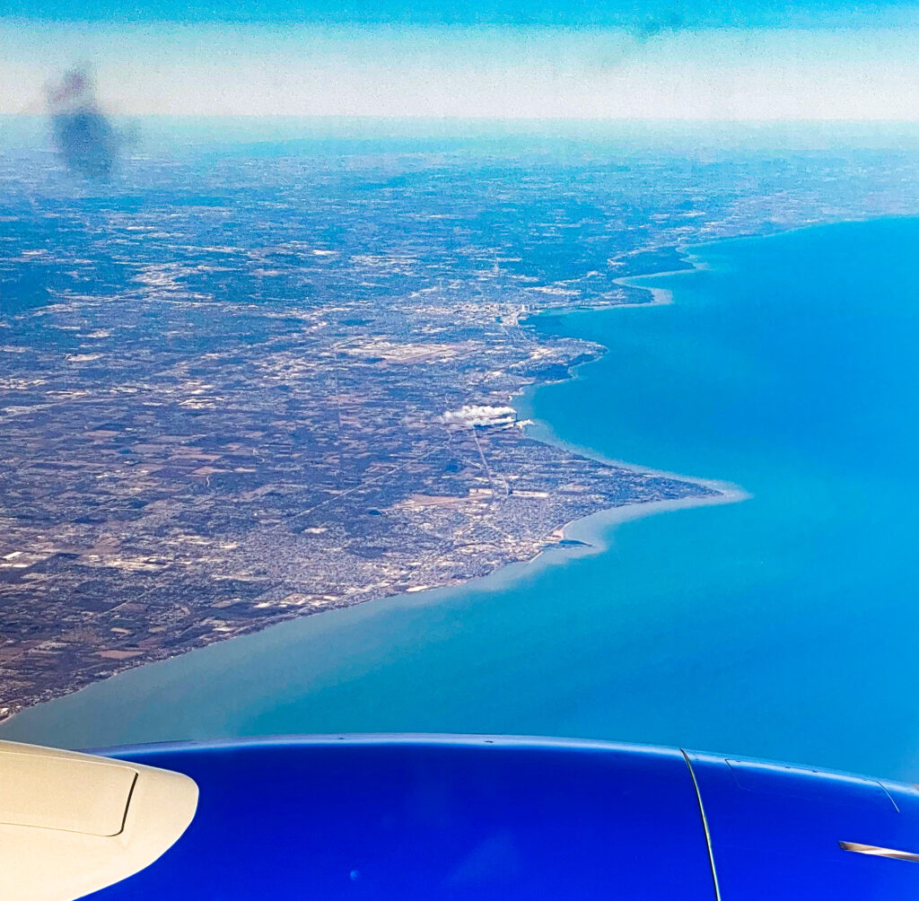
Less than a minute after passing the Kenosha Airport, we started the flight across Lake Michigan.
What you see here is the southeast coast of Wisconsin.
Our plane landed about fifteen minutes later after crossing Lake Michigan. Clouds over our home in Grand Rapids prevented me from taking any further photos of the scenery below.
As an “aviation nerd” I simply enjoy taking picture during these flights.
For those of you who might wonder how I can know the name of the airports in the photos that I take from 35,000 feet or so, please refer to an article at my other website https://stayfocusedpress.com/?p=13070