Category Archives: photograph

A Tunnel Over The Highway

Black Mesa, Arizona

I have been driving back and forth annually along US 160 on my way to/from the Phoenix area for at least twenty years.

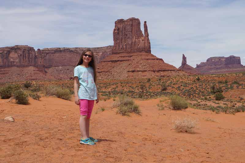
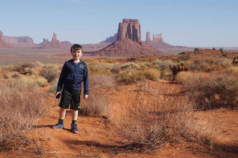
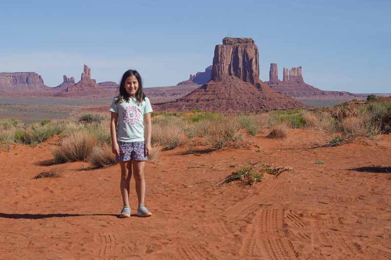
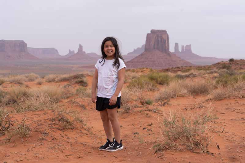
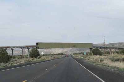
As an avid photographer, one of my favorite scenic locations is Monument Valley Navajo Trial Park located near in Kayenta, AZ. Not far from Kayenta I would pass by an unusual structure that crosses over the highway.

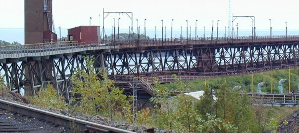
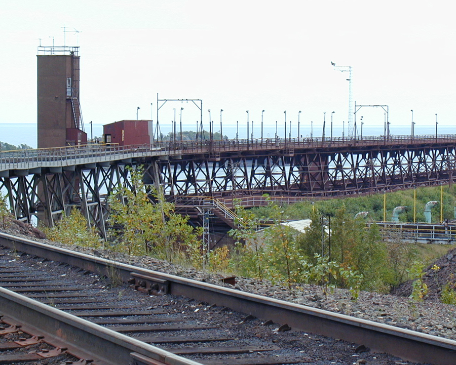
I was curious about this tunnel-like bridge in the area known as Black Mesa and did a search to see if I could find out the purpose of the structure. Here’s a little history about the two photographs below known as the Kayenta Mine.

Peabody Mining

Going back to 1964, Peabody Western Coal contracted with the Navajo and Hopi Tribes for the mineral rights on the mesa and use of its large underground aquifer. The company constructed two coal strip mines – one higher up on the mesa and a second in Kayenta.

The two operations regularly pumped 3 million gallons of water from the aquifer daily to wash and then transport a slurry of coal. Peabody constructed a 275-mile pipeline that carried the coal slurry to Laughlin, NV to generate electricity.

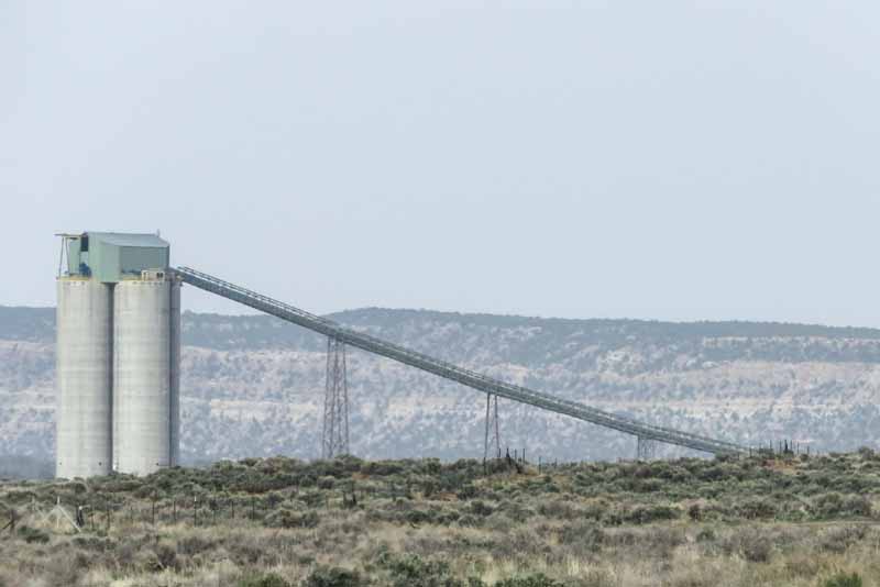
The coal mined in Kayenta was transported on a long conveyor belt (I called it an elevated tunnel) to a large silo. This coal was later shipped by train to the Navajo Generation Station in nearby Page, AZ.


The elevated conveyor carries coal across US Highway 160

The coal is stored in this silo awaiting transport by train to Page, AZ

Controversey Over Water Usage

The two tribes soon claimed that the use of so much water from the aquifer was causing a decline in the amount potable water for their personal, farming and livestock operations. Additionally, this volume of water was not in keeping with the tribes’ cultural and religious need for clean water.

By the end of the 1990s, opposition to Peabody’s strip mining of the mesa had taken hold and the Black Mesa Mine’s last day of operation was December 2008.

Operations at the Kayenta Mine ended in late 2019 as the Navajo Generation Station closed.

The overhead conveyor and silo are no longer in use but the Navajos and Hopis in Black Mesa are hoping for environmental mitigation to their sacred lands.

For more information about Black Mesa click here.

Riding The Rails

A 70 Mile Journey in Minnesota

I grew up the the New York City area and would regularly take 45-minute long ride on the passenger train from New Rochelle to Grand Central Station. Did this qualify me as a rider of the rails? Let’s see.

Some 20 years ago I was involved developing software for personal computers. One of our projects was to make simulations for trains. We found an interesting and unique train route that delivered raw materials from a mining area in Minnesota to the awaiting freighters along Lake Superior – known as the Erie Mining Corp route.

My task was to research the terrain and surroundings along the route so that we could reproduce the journey in a simulation. After arranging the “special” trip with the LTV Corporation (which owned the EMC route), I drove to Hoyt Lakes to meet with two members of the staff.


When I arrived, I was escorted to the rail head where we climbed aboard a vehicle that was outfitted to travel on the rails. I was seated in the front with a video camera where I would record all 3-1/2 hours of trip through the hills, mountains and flatlands to Taconite Harbor on north shore of Lake Superior.


This modified Ford pickup truck was specially fitted to ride and self-propel on the standard tracks.

On the right is one of the diesel freight locomotives that pulled the taconite pellets from Hoyt Lakes to Lake Superior.


It was an interesting ride – the tracks took us through forests, into narrow canyons, along open and hilly fields, passing rocky mountains, traversing bridges, through a tunnel and over rural road crossings.

For me the highlight of the trip was the 30 seconds or so that are illustrated below.


Erie Mining Corporation Route
Here we slowed down as we came upon a local resident as we were riding the tracks from Hoyt Lake to Taconite Harbor, MN

Towards the end of the route we arrived at Taconite Harbor. Below is the large unloading area where the taconite pellets are unloaded onto large lake freighters.

Approaching Taconite Harbor
Quadruple speed arrival into Taconite Harbor


This journey in 2001 was the only time where I actually felt that I was riding the rails. An interesting and memorable ride.

Same Place, Different Face

For almost twenty years I’ve been flying to the Phoenix area in April or May to drive Mom’s car back to Michigan while she takes the quick way home by plane. I like driving and this is convenient way to retrieve her car and to spend few days sightseeing.

My wife Kris and I have quite a few grandkids. We thought it would be a treat for one of them to ride along and visit some of the “wonders of the West” on a road trip back to Michigan. This was also a great opportunity for Grandpa (me) to spend a few days together one-on-one. One of the grandkids and I would fly to Phoenix for a day or two to visit and then we’d be ready to hop in Mom’s car for the return trip.

For six different years you can see that I stopped to show them one of the most scenic places in America. Monument Valley Navajo Tribal Park is part of the Navajo Nation in the northeast corner of Arizona near the town of Kayenta. In the valley is a 17-mile drive along which you’ll gaze at dozens of jaw dropping sandstone cliffs and buttes. I tried to stop in the same general area to record each grandkid with Merrick Butte or West Mitten in the background.


Ezra 2011


Eden 2014

Ezra and Eden 2014


Logan 2015


Ezra 2015


Lyon 2018


Izora 2019


Adeline 2022

I treasure these pictures so that I have made 20″ x 30″ poster size enlargements of each of them.

They represent great memories for me and hopefully for each of these grandkids as well.